This 2002 Memorial Day weekend we did a very nice backcountry ski tour in the North Cascades. Here's the chronicle. It was our third attempt to ski from Rainy Pass to Cutthroat Pass. Actually, we intended to do an overnight ski trip, skiing from Rainy Pass to camp at Maple Pass, then skiing to, and possibly climbing, Corteo or Frisco Peak. But the weather did not cooperate. Click on any photo to see a larger version.
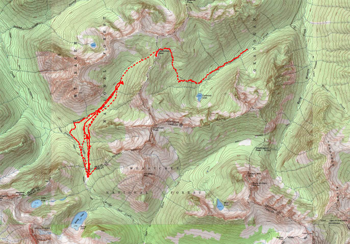
Here's the GPS tracks of the routes we took, on our three trips to attempt this route. There is incomplete coverage due to foliage.
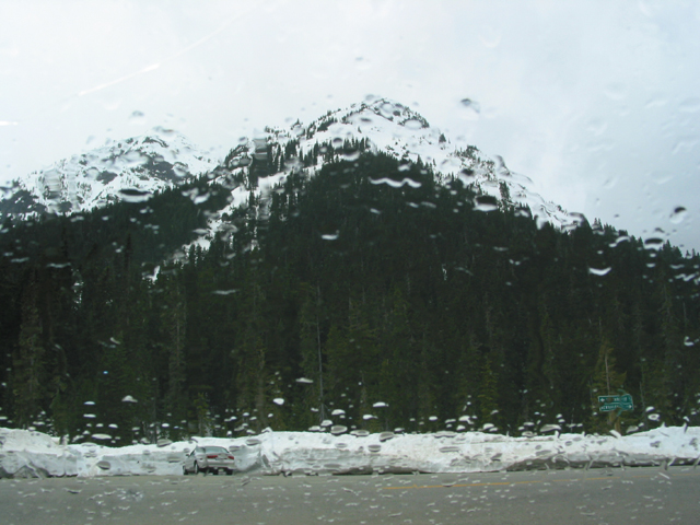
Rainy Pass - and raining. End of ski backpack trip. We'll camp in the snow, and we'll camp in the rain, but we won't camp in the snow in the rain! So we drove to Winthrop and hung out for the day, finishing with a nice dinner at the Duck Brand. Then, back to Rainy Pass to sleep in the back of the Explorer.
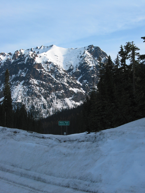
The next day dawned sunny and bright. However, we were concerned that the rain and warm weather would destabilize the snowpack. So we canceled our plan to ski up to Maple Pass, as there are large, steepish open slopes just below the pass by the two routes I knew about. So instead, we decided to stay on less steep terrain, and ski up to Cutthroat Pass.
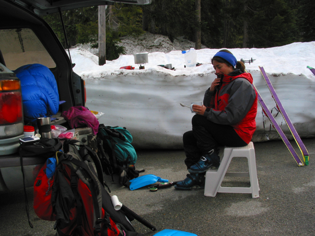
Of course we slept in, and had a leisurely breakfast!
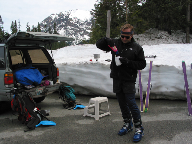
Don't forget the pink Squeeze-Parkay in the oatmeal!
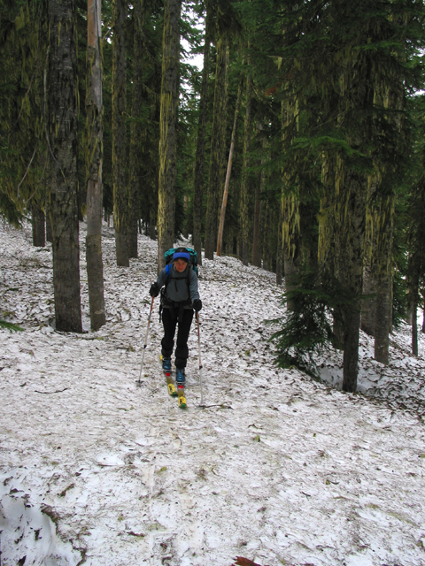
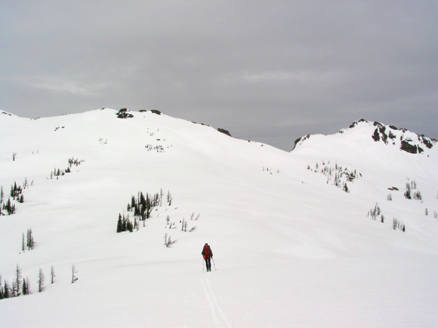
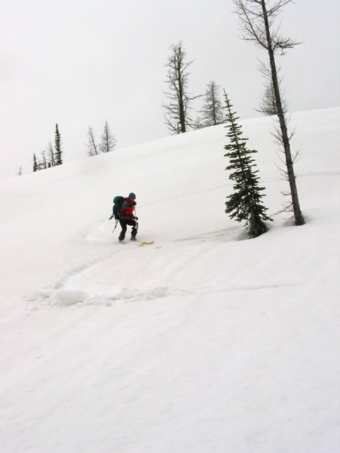
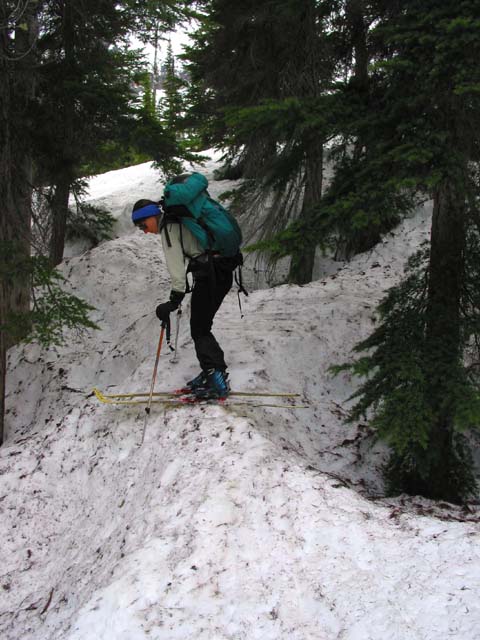
The first part of the trip follows the Pacific Crest trail through the forest, contouring around 4900' for a while. We've been on this part of the tour three times now, and have never seen a trace of the trail. However, the forest is pretty open and flat at first. Don't turn up into the drainage of the first creek you come to, it will take you into the wrong cirque.
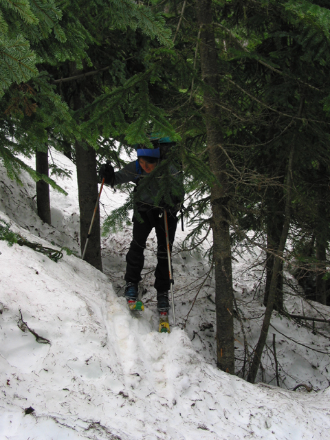
On the traverse, we started climbing slowly towards 5200', which you should reach just as you turn the corner into the Porcupine Creek drainage. The terrain gets steeper and there may be lots of thick patches of small trees before you make your turn, depending upon your actual elevation. Don't make the turn until you can plainly see the high reddish brown cliffs on the other side of Porcupine Creek.
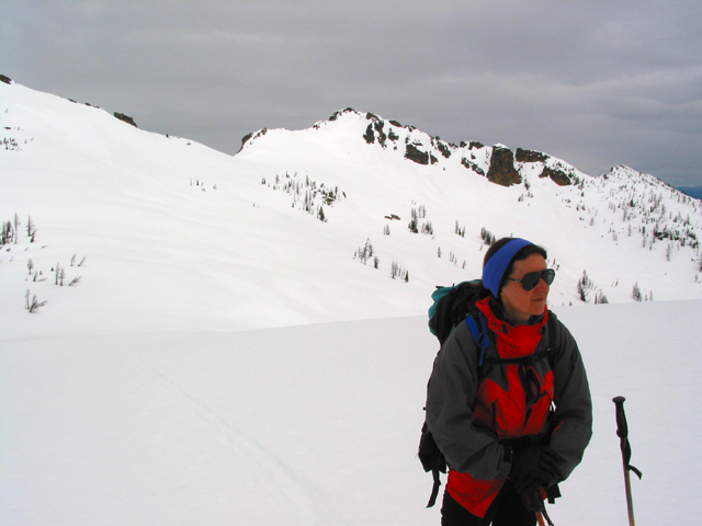
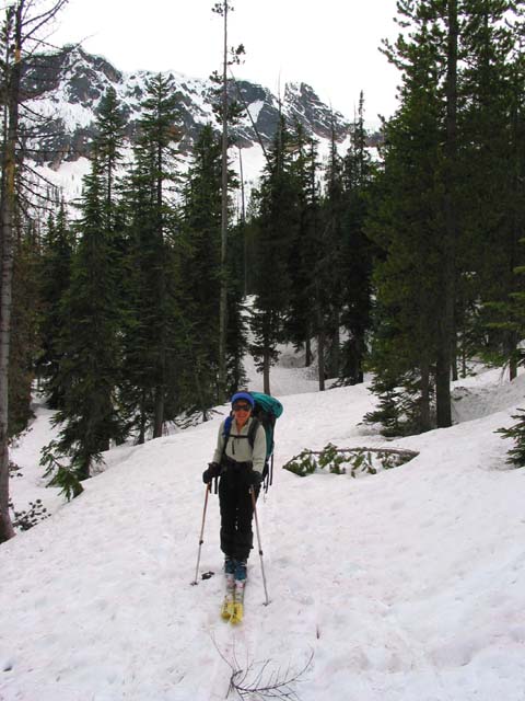
After we entered the Porcupine Creek drainage, we stayed on the right side of the creek. The terrain is quite flat and the forest pretty open. Finally, we reached Cutthroat Pass itself - here is Anne cresting the ridgeline at the Pass. Of course, that nice weather didn't stay around long. A high overcast soon moved in, and the thickened and lowered.
Anne gains the small knob to the East of the pass, on the ridge...
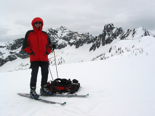
Here we are, set for panoramas...
...and here's a 360-degree panorama from the top of the knob.
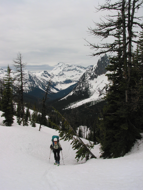
The scenery is spectacular...
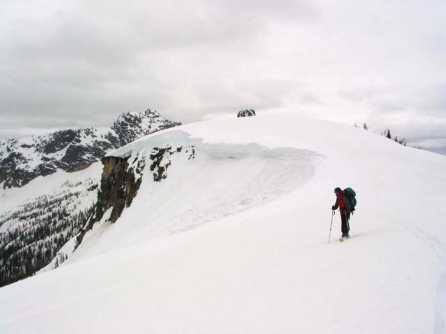
We decided to continue over the Pass and drop into the Cutthroat Lake drainage, which will eventually exit down on Highway 20 below the Switchback at Liberty Bell. There are some nice open slopes at the top of the Cutthroat Lake drainage. The snow was - well let's just say it wasn't powder.
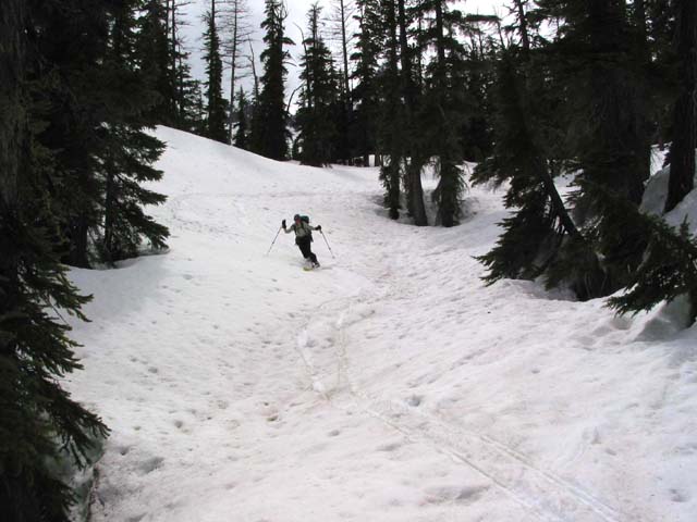
Back in the trees, we followed streambeds now and then.
There was a fair amount of traversing and kick turning.
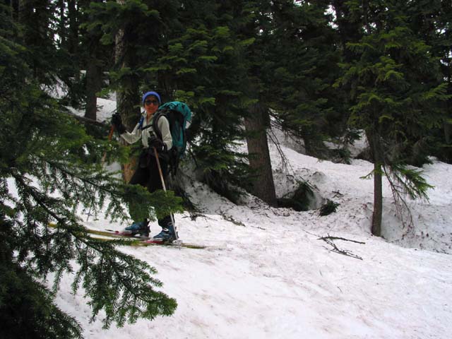
Finally we reached the bottom of the valley, below Cutthroat Lake. The trees opened up now and then.
But we rarely went a hundred yards without encountering an interesting tree well problem.
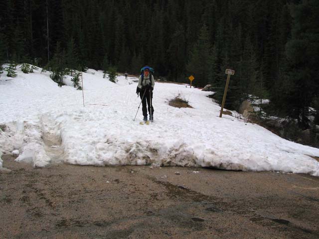
And then, finally, we reached the end of the Cutthroat Lake road, where it intersects Highway 20. We skied on snow nearly the whole way, except for a wooden bridge and a few feet of grass here and there. We met some other skiers coming out, not too far from the road. They offered to take us back to Rainy Pass, so we didn't have to hitch-hike.
A major avalanche closed Route 20 the next day near Washington Pass. It is reported to have left a pile of snow across Route 20 that was 100 feet wide and 30 feet deep. We drove over that piece of road five times over the weekend, and might have even stopped right there to photograph Liberty Bell. Whew!